The key to planning a hike is calculating walking times. Only then can you plan your outings.
As a general rule: Calculations are good, but trying it out is better. Especially when hiking in unfamiliar terrain, it’s essential to do a reconnaissance hike to verify the estimated walking times.
Reading Data from the Map
Before you can calculate the walking time, you must read the necessary data from the map. Alternatively, you can use a software tool for this (see the “Software Tool” section).
Horizontal Distance
The horizontal distance can be determined from the map in several ways:
- Lay a string across the path and then measure it (stretched out)
- Mark off segments of the hike on the edge of a piece of paper and then measure them
- Trace the route with a map wheel and then read the measured value
- Measure the route on Google Earth using the “Trail” feature (drawback: the route must be located on the satellite image)
Elevation Gain
In most cases, the most important waypoints on the map are already labeled with elevation data. Alternatively, elevation differences can be determined using the contour lines and the equidistance. Note: The equidistance on 1:25,000 maps is 10 m in flat terrain, but 20 m in the mountains!
Calculating Marching Time
Marching time is determined based on marching speed and Lkm (performance kilometers).
Many factors must be taken into account when determining marching speed:
- Age and fitness of the participants
- Luggage load
- Group size
- Duration and frequency of breaks
- Distance to be covered
- Weather, temperature
- Time of day
- Participants’ well-being
Generally, the walking speed in groups ranges between 4 and 5 Lkm/h.
Performance kilometers are calculated based on horizontal distance, elevation gain, and steep descent. The following applies:
1 Lkm = 1 km horizontal distance = 100 hm ascent = 150 hm steep descent (>20%, i.e., more than 20 hm over a 100-meter horizontal distance)
Calculation example:
A circular hike covers 7.2 km of horizontal distance, 350 hm of ascent, and 50 hm of steep descent. The group walks at a speed of 4.5 Lkm/h. How long is the walking time (excluding breaks)?
Total distance = 7.2 Lkm (horizontal) + 3.5 Lkm (ascent) + 0.3 Lkm (descent) = 11 Lkm
Walking time = Total distance : Speed = 11 Lkm : 4.5 Lkm/h = 2.44h = 2h 26min
Breaks
Regular breaks are absolutely essential when hiking. However, you shouldn’t take too many, otherwise you won’t make as much progress as you’d like and the hike will drag on.
A good rule of thumb is to take a 10-minute break after 50 minutes of walking. Especially with older participants, this can be communicated before the hike begins. This helps prevent grumbling, since the schedule is clearly established. In addition, longer hikes include longer breaks, such as a lunch break.
Walking Time Table
When planning a hike, you should calculate the hiking time for each section of the route. These values can then be entered into a hiking time table, providing you with a clear schedule that includes split times for the entire hike.
The easiest way to create such a table is to use the Youth+Sport Excel template. All you need to do is enter the horizontal distances between the waypoints, their elevations, and the walking speed into this table. The rest is calculated automatically. You can also enter break times. The route profile is also generated automatically.
Instructions and an example are included in the tabs of the Excel file
Note: The J+S template ignores steep gradients!
Youth + Sports Marching Time Table
Software Tool
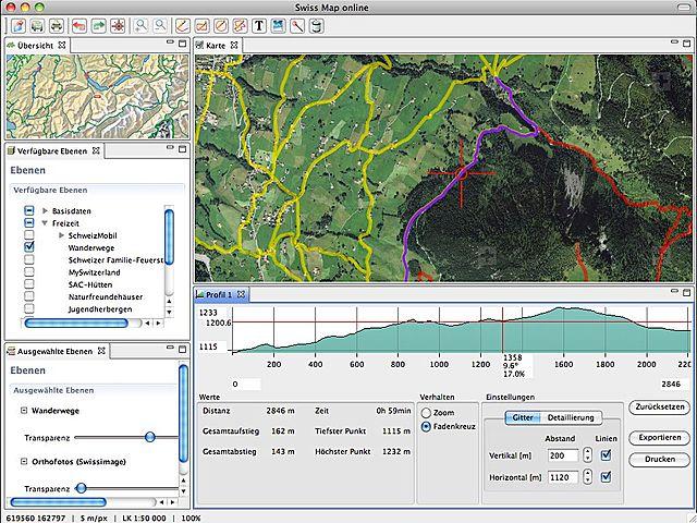
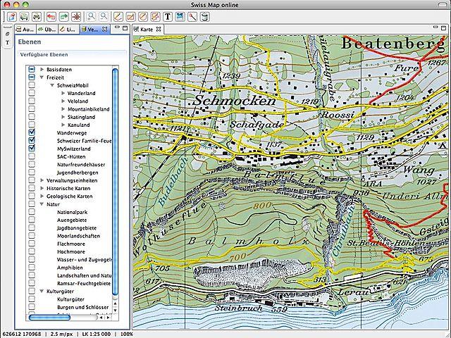
The Federal Office of Topography, swisstopo, has been offering the Swiss Map software for some time now. This software is designed for planning hikes.
In versions prior to June 2011, all map data was stored locally on the computer. Since then, the product has been called Swiss Map Online and retrieves map data directly from the Internet. The advantage is that the map data is always up to date. The software tool costs 49 CHF for the first year and 29 CHF for each additional year.
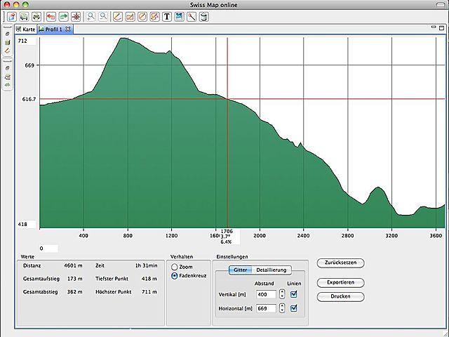
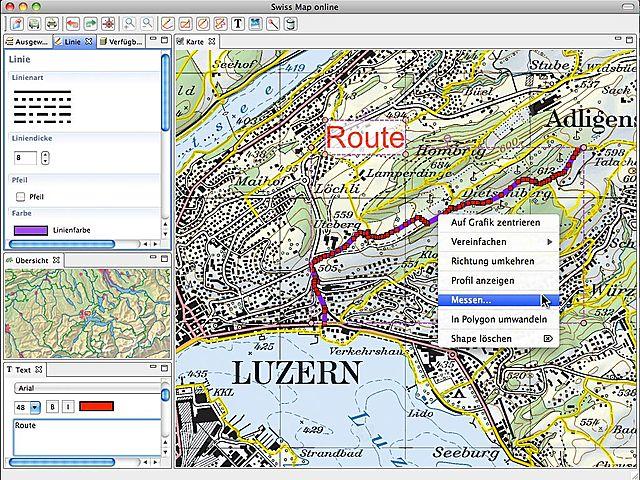
Most hiking trails are already stored in the software and can be linked together with a few simple clicks. Alternatively, you can also plot your own route. Once you’ve put together your hiking route, you can view the horizontal distance, the ascent, the descent, a calculated walking time (though the walking speed remains unclear), and a detailed route profile (see cover image).
Recorded hiking routes can be saved as an .xol file (overlay file) and retrieved at any time.
This tool does not replace the hiking time table. It simply makes it easier to record data from a hike. It is also very accurate.
Swiss Map Online
map.geo.admin.ch
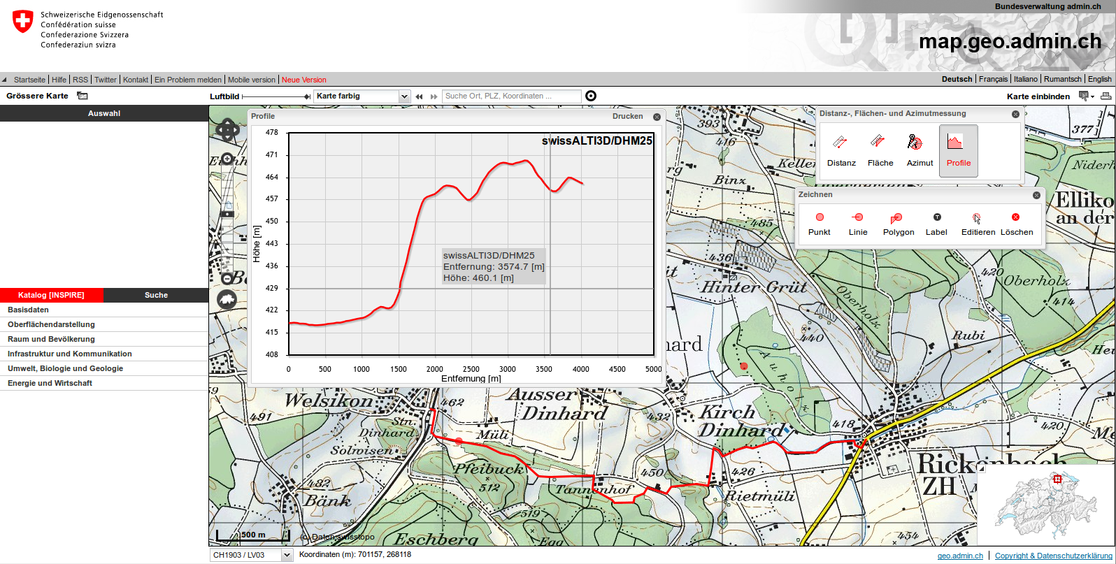
On the map.geo.admin.ch website, all maps of Switzerland are available online for free and without registration. You can view or print them there at various scales.
Using the additional features in the upper right corner, you can also draw points, lines, or shapes. Ideal for orienteering courses. You can then print the maps right away.
The additional features also include a tool for generating an elevation profile. These can be easily used to calculate hiking times.
Screenshot from map.geo.admin.ch
Notes
- The condition of the trails is not taken into account in the calculations; expect longer hiking times on trails in poor condition.
- You should always factor in extra time (e.g., if you need to catch a public transportation connection).
- For J+S camps, at least one leader must have completed the Mountain Trekking Safety Module for alpine hikes.
References
- Cover image: Swiss Map elevation profile, provided by Jungschar Schinznach / Manuel Meier
- Hiking Time Table: Youth + Sport, Camp Sports/Trekking --> Downloads
- Swiss Map online: Federal Office of Topography swisstopo (appropriate authorization has been obtained)
- Screenshot of map.geo.admin.ch: Screenshot from map.geo.admin.ch